Vivarium
> Militaria
> 1914-1918
> Luftbilder und Stellungskarten
|

|
| Jahr: |
1918 |
| Bemerkung: |
|
| ArtikelNr. |
8265 |
E-Mail
|
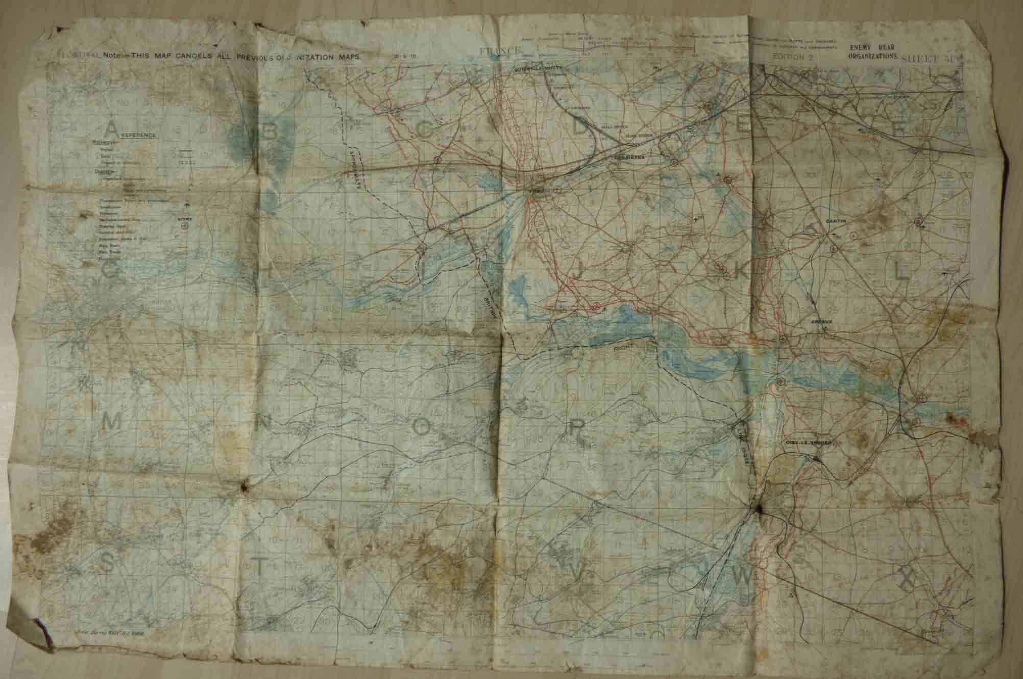
British trench map 15.9.1918: East of Arras, Oisy-le-Verger, sheet 51B
Trench map, Stellungskarte, ca.56x85cm, scale 1:40.000 (metres). Spotted, traces of use, fleckig, Läsuren, sonst gut. The map saw service in the fields, see original soil on the bottom! It was bought 2017 at ebay.de, maybe it got into the hands of a german soldier in 1918 and found its way to Germany at the end of the war.
The map shows front lines at 15.9.1918, while the British were constantely attacking. German first trenches are called “Fresnes-Rouvroy line” and “Droucourt-Quéant line” in the north, in the south “Canal du Nord line” and “Marquion line”. Front-line villages: Oisy-le-Verger, Arleux, Vitry-en-Artois, Quiery-la-Motte.
(c) Ingo Hugger 2020 |
livre@cassiodor.com
